No, we use it to vote.
It seems a little inefficient to put all the airports together
Its really not so bad once you get over the 12 hour drive.
So nice of the 100 largest land owning families to have the same amount of land as the entire urban or rural housing population of the rest of the country. I assume it's to fatten themselves up for the rest of us just like the cows.
When do we get to eat them again?
Shit I'm hungry now I'll start the smoker
Why do they keep allocating land to wildfires if they're so destructive? /s
That's the federal wildfire sanctuary established by president William McKinney. While most fire has been domesticated, the remaining feral fire is allowed to burn free in Utah.
I heard that even though the fire was born here, it has illegal flameborn parents so they’re going to put it on a cargo ship with a bunch of pallets and deport it and that’s how we’ll solve the wildfire issue. Saw it on Joe rogan
Can't rake everywhere all the time
So, if most people are going vegan, there would be much more space for other stuff, yes?
Golf is way too big, imo. No other sport even makes the list here.
Maybe we can combine it with "wildfires".
Some land is not worth anything but a golf course. An acre here is not the same as an acre there.
Here in NW Florida the topsoil is paper thin, total crap. We seem to do fine growing pine for lumber and planting solar farms. Head further north and it's a whole different story. Break slavery populations down by county, you got a soil map. Again, land is not necessarily useful land, if that makes sense.
Don't give a shit about golf, but I've heard modern ranges are family and eco friendly, park like. Anywhere you've sectioned land off from concrete and asphalt development is a win. Hell, we have a solid and varied bird population at Lowe's, along with some hawks that regularly patrol, just from our outdoor section and a little surrounding bit of woods. Weird, I know, didn't expect that. Can't wait to see what the insect population looks like in a couple of months.
Fuck golf
Yeah that land could be used for more christmas trees
Ban golf and replace all courses with public housing
Gotta see one of these with parking.
It would be a subset of "urban commercial", right? Somewhere in the range of half to three-quarters of it?
Depends how these are defined. Public parking or on-street parking are likely in a different category, not to mention people's driveways.
It's quite interesting that "rural highways" is one of the categories identified, but not any other sort of improved road. The data source has a base granularity where one square is 250,000 acres (~100,000 hectares), and then additional state data is factored in for increased precision. It supposingly being USDA data, they might primarily care only about those highways used to connect farms to the national markets.
That said, I would be keenly interested in the land used for low-volume, residential streets that support suburban and rural sprawl, in comparison to streets in urban areas. Unlike highways which provides fast connectivity, and unlike dense urban-core streets that produce value by hosting local businesses and serving local residents, suburban streets take up space, intentional break connectivity (ie cul de sacs), and ultimately return very little in value to anyone except to the adjacent homeowners, essentially as extensions of their privately-owned driveways.
It may very well be in USDA's interest to collect data on suburban sprawl, as much of the land taken for such developments was perfectly good, arable land.
I love this visualization and for some reason your comment made me also wish we had this data correlated with the water usage for each land use category.
There'd be a square or two which just say "Nestlé" lol
Man that guy Urban needs so many houses... What does he even do with them all?
"Wildfires" is a surprisingly large area. I wonder what the 2025 area for it is.
I have certainly heard of Weyerhauser, but had no idea they were that big. They're the only 'individual' owner shown. The land-owning families is odd as I'm sure it overlaps a lot with pasture and private timberland.
They have rights to nearly all the timberland in washington, which covers about half the state. They're unbelievably huge, it's ridiculous.
I think the graphic would be better if some of the data were nested by size and relationship. IOW Agricultural land would have grazing, food production, feed production, etc. in decreasing size nested over an area. Might give greater sense of how much land is used for ag. Same for forestry; Forestry, parks, commercial logging, etc.
Remember, not all land is the same. Some is too dry to grow human food. Some too wet. There are also other things that land is either too or not enough.
I bet we could still multiply output by a decent number by replacing meat production with directly edible crops, if there was a need for it
It us wild that there is not a need. Distribution is (or was) the issue. Very sad humans refuse to feed others.
Too cold or not enough warm.
Can we put the 100 largest landowning families in Florida, then saw it off from the rest of the country?
no need to saw, when invasive species and the ocean is taking over. because florida loves to import all the illegal exotic animals, they got plenty reptiles, giant snails, giant rats. the latter 2 both carry nasty parasites.
Giant rats? I don't believe they exist
Shit, there are landlords in the snails?
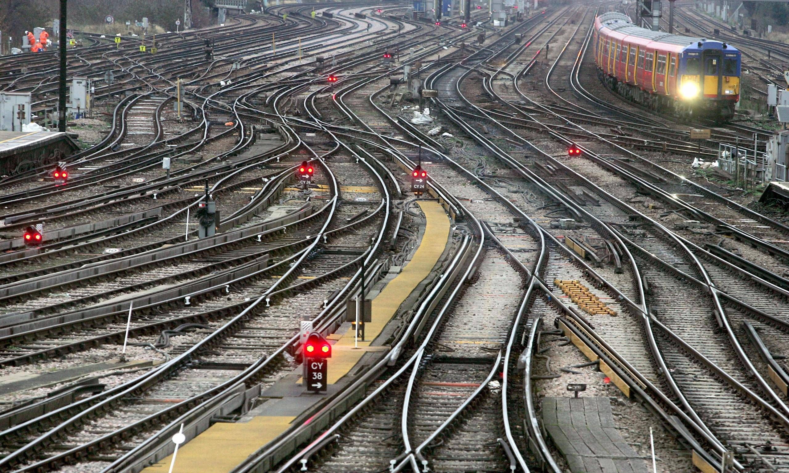
I would love to flip the railroad usage and cow pasture usage.
Also, mfs drinking too much corn syrup.

beautiful
theresa tiny part thats for maple syrup
Where's the amounts used strictly for cars?
The black lines used for borders could be that. I'm not saying it is, just that it might be close to the amount used by roads other than rural highways.
Get rid of livestock
Tobacco is still at least 2,000x too big.
Can't figure out why the 100 largest landowning families aren't using their land for any of the other reasons. Surely some of them are having it farmed for them too?
OIL. There's a LOT of land that might be considered cow/grazing but won't really grow anything worth it. See West Texas.
Swamps don't make good farms, but some people try to farm in FL, it's just inefficient and heavily pollutes or eliminates wetlands
Very interesting! Now do one for EU, please.
Do we not eat any of the cows?
I expect a substantial portion of that cow pasture/range land is dry grasslands and shrub steppe out west. It's rough terrain and not good for much else. A lot of it doesn't even have cows on it most of the time.
It simply takes a loooot of food to produce 1kg of beef
Yes, and we grow cows on land that isn't suitable for much else.
Vegans and ecologists have been talking about this exact issue for a while now
literally decades. lots of talk around the conditions that bring new pandemics too.
if its alafalfa, i think alot of farm land are, its usually exported to the Middle east.
How nice for the Reed family/Green Diamond to be split into 'private family owned timberland' and 'corporate timberland'.
Food we eat is sepperate from cow pastures...
Nice!
This graph is confusing because there are state lines drawn underneath, but it’s not saying by state.
Defense is a surprisingly large use of land. How is that? Can anyone explain the most land intensive uses of the Armed Forces? Like tank training areas maybe?
Mikitary bases are pretty big. Air force, army, national guard, naval air stations, naval bases, there is a lot going on there.
and somebody owns every square inch of it.
This makes my eyes bleed
God I miss living in the west.
This can't be right. Where are all the impenetrable walls of swine?
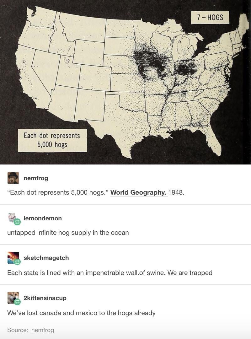
hugging the west coast, there are tons of cow farms, and a small part of cali is for the military, SEAL training.
is Alaska included? or are we just ignored because of our small population?
Probably ignored as that would skew the data making think that the US is still one big wilderness.
Yeah Maine is so well known for it's urban housing
And Nevada for its timberland.