Double punch of hurricanes could become common due to climate crisis
Double punch of hurricanes could become common due to climate crisis
As Floridians prepare to evacuate ahead of Hurricane Milton, debris from Helene still litter swaths of the state
As Floridians prepare to evacuate ahead of Hurricane Milton, debris from Helene still litter swaths of the state
Less than two weeks after Hurricane Helene lashed the Florida coastline, an even more powerful hurricane is hurtling toward the state.
It’s the kind of double hit becoming more common as the climate crisis persists, further complicating hurricane preparation, experts say.
You're viewing a single thread.
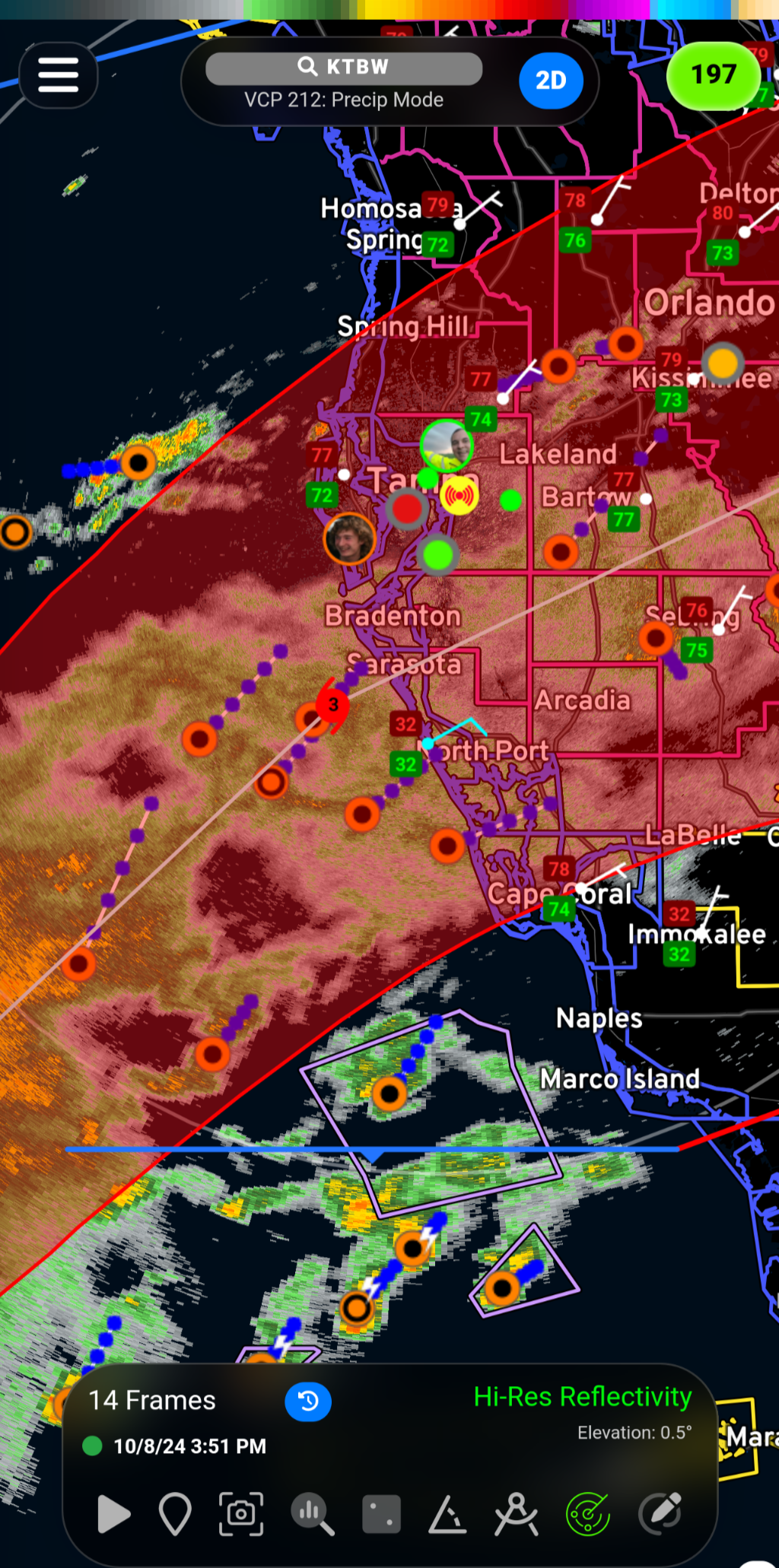
I've been watching the WFLA live feed, which is a St. Pete TV station. They're saying that the storm is now expected to be centered around Sarasota, but Tampa is still inside the cone and it is looking like it might go straight through Sarasota. It is expected to be a cat 3 by then and it will make landfall around 2 am Thursday.
This whole area of the Florida coast is pretty densely packed, so pretty much anywhere it hits will likely be catastrophic.
Worse than the category this time is the huge amount of storm surge. Florida's elevation is lower than many of the forecasted storm surge numbers.
That will definitely be the big problem. I shared this map elsewhere-
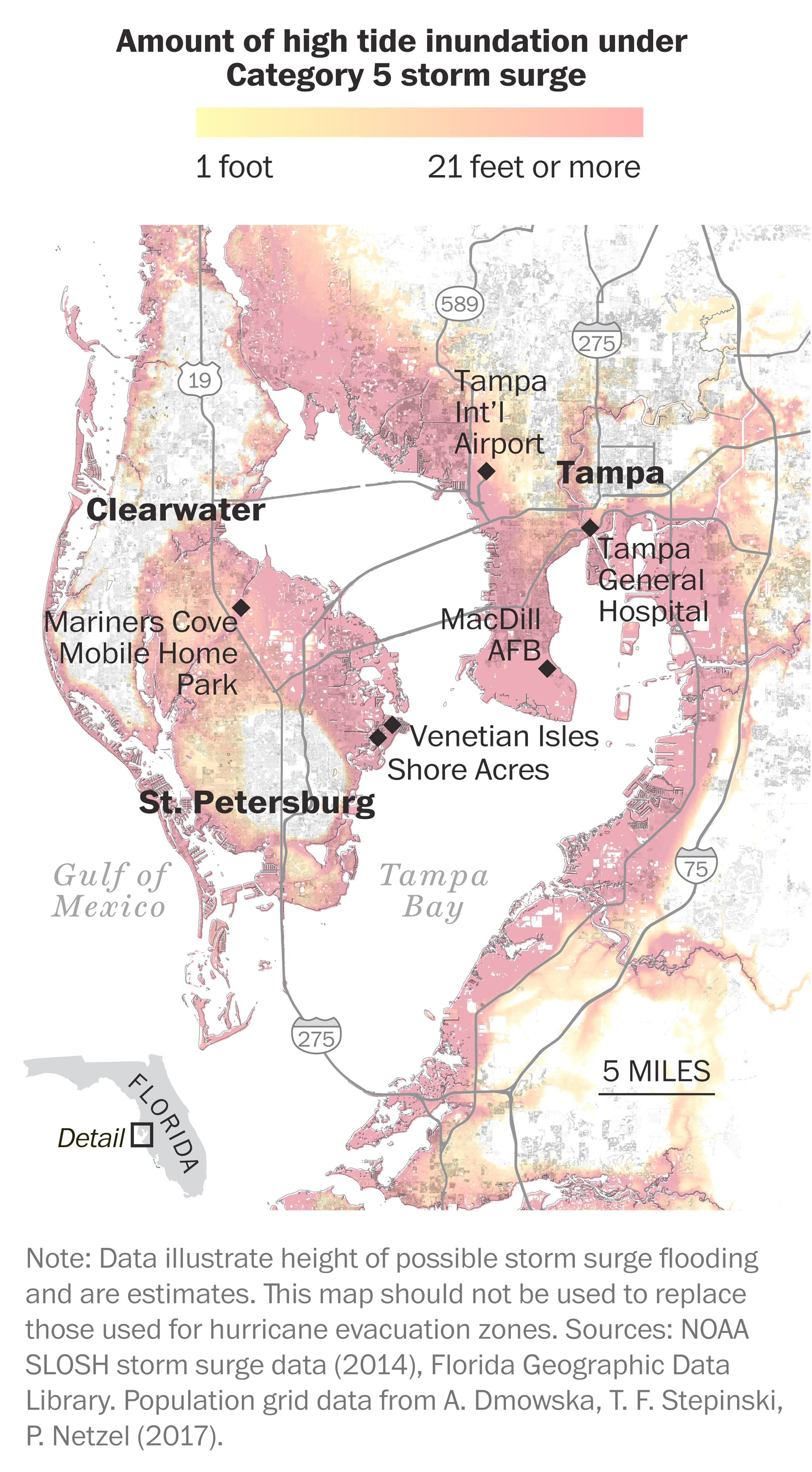
A Sarasota impact is preferred since it forces the storm sirge further south. An impact north of the bay means that all the storm surge gets funneled straight into Tampa Bay and the area of higher population density
They don't source the map properly, so it's hard to say what time that map was taken from, but I guess we'll have to see. Unless it goes way off course, no matter where it makes landfall, it's going to be bad.
You are correct, current models are showing the center of the cone over Sarasota (timezone is pst because that's where I'm at).